Hayri ASLAN
-
Posts
1577 -
Joined
-
Last visited
-
Days Won
134
Content Type
Profiles
Forums
Events
Everything posted by Hayri ASLAN
-
Hello Can you clarify your question?
-
Hello Please use below unimap.pas until we publish new version. uniMap.pas
-
Hello Do you want to disable http port completely or you want redirect users visited "http://yoursite" to "https://yoursite" ?
-
Hello Can you try below solution?
-
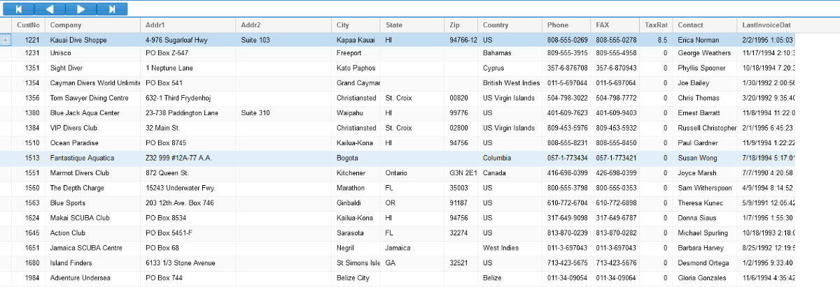
Hello, I was working on RowWidget and I have a solution. procedure TMainForm.UniFormCreate(Sender: TObject); begin with UniDBGrid1, JSInterface do begin JSAssign('findPlugin("rowwidget").getHeaderConfig', [JSFunction('', 'var defaultIconColumnCfg = this.superclass.getHeaderConfig.apply(this, arguments);'+ 'defaultIconColumnCfg.renderer = function (value, gridcell, record) { '+ // Your logic goes here. column[0] is custno. if it is 1221 show + sign otherwise hide. ' if (record.get(0) === 1221) { '+ ' return ''<div class="'' + Ext.baseCSSPrefix + ''grid-row-expander" role="presentation" tabIndex="0"></div>''; '+ ' } '+ '}; ' + 'return defaultIconColumnCfg;')]); end; end;

-
Hello You can use OnCellContextClick event.
-
Hello, aVector.Options.Editable:= True.
-
Hello Set editable := true
-

Error handling try except end EnabledsynchronousOperation = True
Hayri ASLAN replied to TI.ME's topic in General
Hello What are you trying to achieve? Do you have simple test case? -
Hello Do you have leaflet example?
-
Hello I implemented one of the code that you sent me for area. Do you have example of what you want? So I can add it
-
Hello If you are using professional version, please adjust your email first.
-
Hello 1. Download below file and add into files folder. https://unpkg.com/leaflet-geosearch@3.3.2/dist/bundle.min.js 2. add below code to customfiles files/bundle.min.js 3. add an edit to the form and to search an address run below code procedure TMainForm.UniButton18Click(Sender: TObject); begin with UniMap1, JSInterface do begin JSCode('const provider = new window.GeoSearch.OpenStreetMapProvider();'); JSCallGlobal('var query_promise = provider.search',[JSObject(['query', uniedit4.Text])]); JSCallGlobal('query_promise.then', [JSFunction('e','ajaxRequest('+JSName+', "OnAddressFound", {address: JSON.stringify(e)});')]); end; end; 4. To get the result, add below code to unimap.onAjaxEvent if EventName='OnAddressFound' then begin addressJson:= Params['address'].AsString; end now you will get a JSONArray with found results. You need to parse it. Check below example https://jsfiddle.net/Alechan/L6s4nfwg/ Example addressJSON [ { "x":35.3258349, "y":36.9936175, "label":"Adana, Seyhan, Adana, Mediterranean Region, 01010, Turkey", "bounds":[ [ 36.8336175, 35.1658349 ], [ 37.1536175, 35.4858349 ] ], "raw":{ "place_id":128287, "licence":"Data © OpenStreetMap contributors, ODbL 1.0. https://osm.org/copyright", "osm_type":"node", "osm_id":26480399, "boundingbox":[ "36.8336175", "37.1536175", "35.1658349", "35.4858349" ], "lat":"36.9936175", "lon":"35.3258349", "display_name":"Adana, Seyhan, Adana, Mediterranean Region, 01010, Turkey", "class":"place", "type":"city", "importance":0.7673464411826116, "icon":"https://nominatim.openstreetmap.org/ui/mapicons//poi_place_city.p.20.png" } }, { "x":35.4984094, "y":37.1438001, "label":"Adana, Mediterranean Region, Turkey", "bounds":[ [ 36.2630414, 34.7392967 ], [ 38.4046019, 36.4095784 ] ], "raw":{ "place_id":257827537, "licence":"Data © OpenStreetMap contributors, ODbL 1.0. https://osm.org/copyright", "osm_type":"relation", "osm_id":167216, "boundingbox":[ "36.2630414", "38.4046019", "34.7392967", "36.4095784" ], "lat":"37.1438001", "lon":"35.4984094", "display_name":"Adana, Mediterranean Region, Turkey", "class":"boundary", "type":"administrative", "importance":0.7673464411826116, "icon":"https://nominatim.openstreetmap.org/ui/mapicons//poi_boundary_administrative.p.20.png" } }, { "x":35.33124175868778, "y":37.02213715, "label":"Adana, Kışla Mahallesi, Yüreğir, Adana, Mediterranean Region, Turkey", "bounds":[ [ 37.0216189, 35.3304464 ], [ 37.0227239, 35.3321308 ] ], "raw":{ "place_id":237840251, "licence":"Data © OpenStreetMap contributors, ODbL 1.0. https://osm.org/copyright", "osm_type":"way", "osm_id":754261366, "boundingbox":[ "37.0216189", "37.0227239", "35.3304464", "35.3321308" ], "lat":"37.02213715", "lon":"35.33124175868778", "display_name":"Adana, Kışla Mahallesi, Yüreğir, Adana, Mediterranean Region, Turkey", "class":"leisure", "type":"park", "importance":0.35000000000000003 } }, { "x":35.31912610457783, "y":37.0036959, "label":"Adana, Atatürk Caddesi, Adana, Seyhan, Adana, Mediterranean Region, Turkey", "bounds":[ [ 37.0035359, 35.3188148 ], [ 37.0038454, 35.3194402 ] ], "raw":{ "place_id":317402933, "licence":"Data © OpenStreetMap contributors, ODbL 1.0. https://osm.org/copyright", "osm_type":"way", "osm_id":153300717, "boundingbox":[ "37.0035359", "37.0038454", "35.3188148", "35.3194402" ], "lat":"37.0036959", "lon":"35.31912610457783", "display_name":"Adana, Atatürk Caddesi, Adana, Seyhan, Adana, Mediterranean Region, Turkey", "class":"railway", "type":"station", "importance":0.201, "icon":"https://nominatim.openstreetmap.org/ui/mapicons//transport_train_station2.p.20.png" } } ]
-
Hello I'm able to compile and install new version. What error message are you getting?
-
Hello We will publish next build tomorrow. We are actively working on Server Farm. We are planning to release HyperServer Server Farm in this month.
-
Hello It is ready and will come with next build. We are working on some hyperserver features and planning to release by end of the month.]
-
-
When you click the button, it will disable it until the response so no one can click again.
-
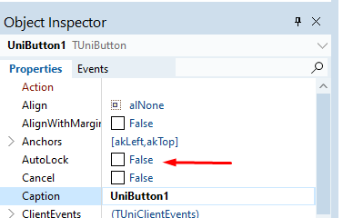
And what is the type of close button? is it UniButton? We have autolock property for unibutton
-
You can use Unifileuploadbutton instead of unifileupload
-
The is the latest. Are you using UniButton? How they are closing your form?
-
Do to security reasons, you need to click a file input button. There is no solution for this.
-
Which version are you using? It is added recently.
-
Hello Please set Unibutton.AutoLock:=True
-
Please send your test case. It is working in my end